
Topografische kaart Una
Interactieve kaart
Klik op de kaart om de hoogte weer te geven.
Over deze kaart
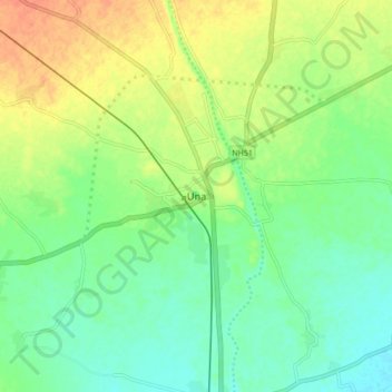
Naam: Topografische kaart Una, hoogte, reliëf.
Locatie: Una, Una Taluka, Gir Somnath District, Gujarat, 362560, India (20.77989 70.99916 20.85989 71.07916)
Gemiddelde hoogte: 25 m
Minimale hoogte: 8 m
Maximale hoogte: 48 m
Una is located on the bank of Machchundri river. It has an average elevation of 14 metres (46 feet). Kodinar is located on the west, Diu is on the south. Una has the highest number of villages of all the Talukas in Gujarat state.