
Topografische kaart Columbia
Interactieve kaart
Klik op de kaart om de hoogte weer te geven.
Columbia
The city has capitalized on this location, which includes three rivers, by identifying as "The Columbia Riverbanks Region". Columbia is located roughly halfway between the Atlantic Ocean and the Blue Ridge Mountains, at an elevation around 292 ft (89 m).
Over deze kaart
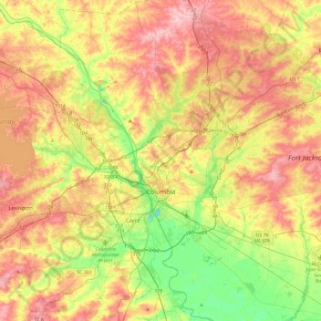
Naam: Topografische kaart Columbia, hoogte, reliëf.
Locatie: Columbia, Richland County, South Carolina, United States (33.94325 -81.17098 34.13160 -80.70382)
Gemiddelde hoogte: 89 m
Minimale hoogte: 13 m
Maximale hoogte: 174 m
Andere topografische kaarten
Klik op een kaart om zijn topografie, zijn hoogte en zijn reliëf te bekijken.
Belleview
United States > South Carolina > Richland County > Columbia > Belleview
Gemiddelde hoogte: 79 m