
Topografische kaart Rancho Santa Fe
Interactieve kaart
Klik op de kaart om de hoogte weer te geven.
Over deze kaart
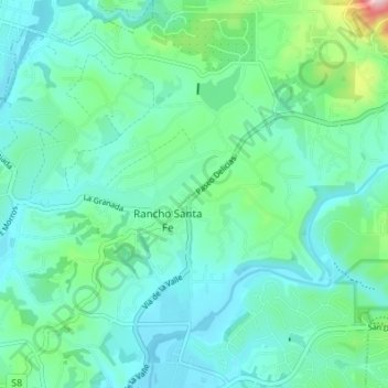
Naam: Topografische kaart Rancho Santa Fe, hoogte, reliëf.
Gemiddelde hoogte: 68 m
Minimale hoogte: 6 m
Maximale hoogte: 331 m
The climate of Rancho Santa Fe is, for the most part, typical of the San Diego metropolitan area though its higher elevation and inland location lends itself to larger temperature variations.