Topografische kaart Srinagar
Klik op de kaart om de hoogte weer te geven.
Srinagar
Srinagar is located at 30°13′N 78°47′E / 30.22°N 78.78°E / 30.22; 78.78. at the left bank of Alaknanda river. It has an average elevation of 560 metres (1,837 feet). It is the largest town in the Garhwal Hills. It is reached by national highway NH58 from Rishikesh, Srinagar is about 104 km from Rishikesh which is the last city on the plains of Uttarakhand and from where the mountains start. Srinagar can also be reached via Kotdwara, from Kotdwara it takes maximum 5 hours to reach there.It is a municipal board in the Pauri district of uttarakhand which is now upgraded to Municipal Corporation recently.
Over deze kaart
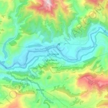
Naam: Topografische kaart Srinagar, hoogte, reliëf.
Locatie: Srinagar, Pauri Garhwal, Uttarakhand, 249127, India (30.06313 78.62995 30.38313 78.94995)
Gemiddelde hoogte: 1.355 m
Minimale hoogte: 463 m
Maximale hoogte: 2.704 m
Andere topografische kaarten
Klik op een kaart om zijn topografie, zijn hoogte en zijn reliëf te bekijken.