
Topografische kaart Santa Marianita
Interactieve kaart
Klik op de kaart om de hoogte weer te geven.
Over deze kaart
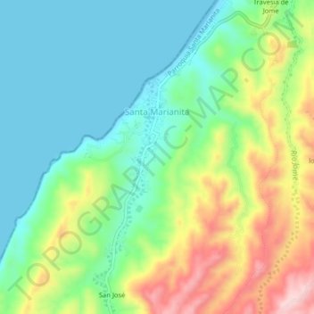
Naam: Topografische kaart Santa Marianita, hoogte, reliëf.
Locatie: Santa Marianita, Manta, Manabí, Ecuador (-1.01564 -80.86785 -0.97564 -80.82785)
Gemiddelde hoogte: 89 m
Minimale hoogte: 0 m
Maximale hoogte: 264 m