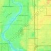
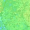
Topografische kaart Lutz
Klik op de kaart om de hoogte weer te geven.
Lutz
Lutz is characterized by a gently rolling topography that showcases the distinctive features of the central Florida landscape. The area has an average elevation of about 70 feet (21 meters) above sea level, contributing to its mild undulations rather than dramatic elevation changes. The terrain is marked by a combination of flatlands interspersed with small hills and wetlands, which play a crucial role in the region's ecosystem. The presence of numerous lakes, including Lake Park and several small ponds, enhances the area's natural beauty and supports diverse wildlife. Additionally, the underlying soil and geology, typical of the region, influence the local vegetation, primarily consisting of subtropical species that thrive in this warm climate. Overall, Lutz's topography is well-suited for residential development while preserving the natural charm of its waterways and green spaces.
Over deze kaart
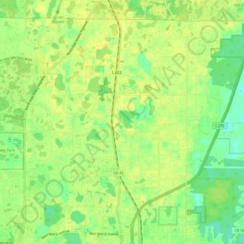
Naam: Topografische kaart Lutz, hoogte, reliëf.
Locatie: Lutz, Tampa, Hillsborough County, Florida, United States (28.09095 -82.50243 28.17250 -82.39456)
Gemiddelde hoogte: 20 m
Minimale hoogte: 6 m
Maximale hoogte: 31 m
Andere topografische kaarten
Klik op een kaart om zijn topografie, zijn hoogte en zijn reliëf te bekijken.







Hillsborough Heights East
United States > Florida > Hillsborough County > Tampa
Gemiddelde hoogte: 18 m


The Borghese Villas at Westshore
United States > Florida > Hillsborough County > Tampa
Gemiddelde hoogte: 9 m







The Borghese Villas at Westshore
United States > Florida > Hillsborough County > Tampa
Gemiddelde hoogte: 9 m










Hillsborough Heights East
United States > Florida > Hillsborough County > Tampa
Gemiddelde hoogte: 18 m
Club Manor East of Grand Hampton
United States > Florida > Hillsborough County > Tampa
Gemiddelde hoogte: 17 m