
Topografische kaart Cinco
Interactieve kaart
Klik op de kaart om de hoogte weer te geven.
Over deze kaart
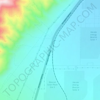
Naam: Topografische kaart Cinco, hoogte, reliëf.
Locatie: Cinco, Kern County, California, United States (35.24330 -118.05618 35.28330 -118.01618)
Gemiddelde hoogte: 713 m
Minimale hoogte: 623 m
Maximale hoogte: 1.191 m
It is located on the southwestern edge of Fremont Valley 6 miles (9.7 km), east of and at the foot of the Sierra Nevada (U.S.) Mountains, south of Red Rock Canyon State Park (California). at an elevation of 2149 feet (655 m). It is southwest of Cantil, California and east of Cross Mountain.