

Topografische kaart Agra
Klik op de kaart om de hoogte weer te geven.
Agra
The region around Agra consists almost entirely of a level plain, with hills in the extreme southwest. The rivers in the region include Yamuna and Chambal. The region is also watered by the Agra Canal. Millet, barley, wheat and cotton are among the crops grown in the surrounding countryside. Both Rabi and Kharif crops are cultivated. The deserted city of Fatehpur Sikri is about 40 km southwest of Agra. The sandstone hills near Fatehpur Sikri and on the south-eastern borders of the district are offshoots from the Vindhya range of Central India. Agra is about 210 km away from the National capital of New Delhi(via Yamuna Expressway), about 336 km from state capital Lucknow(via Agra-Lucknow Expressway), and about 227 km from Kanpur(via Agra-Lucknow Expressway). The city has an average elevation of 170 metres above sea level.
Over deze kaart
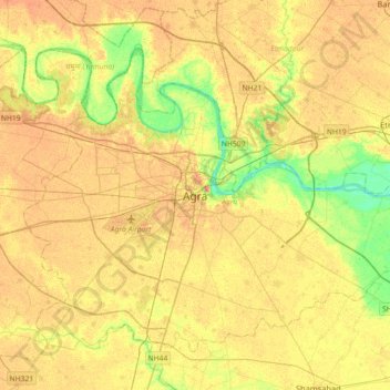
Naam: Topografische kaart Agra, hoogte, reliëf.
Locatie: Agra, Uttar Pradesh, 280001, India (27.01526 77.84982 27.33526 78.16982)
Gemiddelde hoogte: 166 m
Minimale hoogte: 143 m
Maximale hoogte: 181 m