
Topografische kaart Wreck Island
Interactieve kaart
Klik op de kaart om de hoogte weer te geven.
Over deze kaart
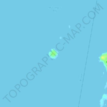
Naam: Topografische kaart Wreck Island, hoogte, reliëf.
Gemiddelde hoogte: 0 m
Minimale hoogte: 0 m
Maximale hoogte: 16 m
Andere topografische kaarten
Klik op een kaart om zijn topografie, zijn hoogte en zijn reliëf te bekijken.
Gilead
United States of America > Maine > Gilead
Gilead, Oxford County, Maine, United States of America
Gemiddelde hoogte: 325 m
Rockland
United States of America > Maine > Rockland
Rockland, Knox County, Maine, 04841, United States of America
Gemiddelde hoogte: 37 m
South China
United States of America > Maine > South China
South China, Kennebec County, Maine, 04358, United States of America
Gemiddelde hoogte: 78 m
Kingfield
United States of America > Maine > Kingfield
Kingfield, Franklin County, Maine, United States of America
Gemiddelde hoogte: 294 m
Jones Hill
United States of America > Maine
Jones Hill, Cumberland County, Maine, United States of America
Gemiddelde hoogte: 75 m
Smith Brook
United States of America > Maine
Smith Brook, Aroostook County, Maine, United States of America
Gemiddelde hoogte: 244 m
Jobs Mountain
United States of America > Maine
Jobs Mountain, Waldo County, Maine, 04848, United States of America
Gemiddelde hoogte: 10 m
Mount David
United States of America > Maine > Lewiston
Mount David, Lewiston, Androscoggin County, Maine, 04240, United States of America
Gemiddelde hoogte: 68 m
Remick Corners
United States of America > Maine > Kittery > Remick Corners
Remick Corners, Kittery, York County, Maine, 03904, United States of America
Gemiddelde hoogte: 10 m
Westbrook
United States of America > Maine > Westbrook
Westbrook, Cumberland County, Maine, United States of America
Gemiddelde hoogte: 41 m
Brown Mountain
United States of America > Maine
Brown Mountain, Oxford County, Maine, United States of America
Gemiddelde hoogte: 403 m
Churchill Island
United States of America > Maine
Churchill Island, Aroostook County, Maine, 04738, United States of America
Gemiddelde hoogte: 205 m