
Topografische kaart Chihuahuan Desert
Interactieve kaart
Klik op de kaart om de hoogte weer te geven.
Over deze kaart
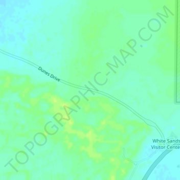
Naam: Topografische kaart Chihuahuan Desert, hoogte, reliëf.
Locatie: Chihuahuan Desert, Otero County, New Mexico, United States (32.78739 -106.18660 32.78749 -106.18650)
Gemiddelde hoogte: 1.221 m
Minimale hoogte: 1.215 m
Maximale hoogte: 1.228 m
There are several larger mountain ranges in the Chihuahan Desert, including the Sierra Madre, the Sierra del Carmen, the Organ Mountains, the Franklin Mountains, the Sacramento Mountains, the Chisos Mountains, the Guadalupe Mountains, and the Davis Mountains. These create "sky islands" of cooler, wetter, climates adjacent to, or within the desert, and such elevated areas have both coniferous and broadleaf woodlands, including forests along drainages and favored exposures. The lower elevations of the Sandia–Manzano Mountains, the Magdalena–San Mateo Mountains, and the Gila Region partly border the Chihuahuan Desert and partly border other ecoregions that are not deserts.
Andere topografische kaarten
Klik op een kaart om zijn topografie, zijn hoogte en zijn reliëf te bekijken.
Mayhill
United States > New Mexico > Otero County
Mayhill, Otero County, New Mexico, United States
Gemiddelde hoogte: 2.104 m
Cloudcroft
United States > New Mexico > Otero County
Cloudcroft, Otero County, New Mexico, United States
Gemiddelde hoogte: 2.643 m
Bent
United States > New Mexico > Otero County
Bent, Otero County, New Mexico, 88314, United States
Gemiddelde hoogte: 1.857 m
Cloudcroft
United States > New Mexico > Otero County > Cloudcroft
Cloudcroft, Otero County, New Mexico, 88317, United States
Gemiddelde hoogte: 2.636 m
Sunspot
United States > New Mexico > Otero County
Sunspot, Otero County, New Mexico, 88349, United States
Gemiddelde hoogte: 2.626 m
Tularosa
United States > New Mexico > Otero County > Tularosa
Tularosa, Otero County, New Mexico, 88352, United States
Gemiddelde hoogte: 1.371 m