
Topografische kaart Krishnanagar
Interactieve kaart
Klik op de kaart om de hoogte weer te geven.
Krishnanagar
Krishnanagar is located at 23°24′N 88°30′E / 23.4°N 88.5°E / 23.4; 88.5. The area of the municipality is around 16 km2. It is situated on the southern banks of the Jalangi River. It has an average elevation of 14 metres (46 ft). The Tropic of Cancer passes through the outskirts of Krishnanagar. The latitude of the Tropic of Cancer is 23° 26′ 5″ N.
Over deze kaart
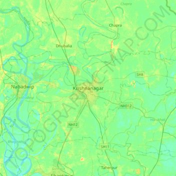
Naam: Topografische kaart Krishnanagar, hoogte, reliëf.
Locatie: Krishnanagar, Krishnagar-I, Nadia, West Bengal, 741101, India (23.24585 88.33589 23.56585 88.65589)
Gemiddelde hoogte: 11 m
Minimale hoogte: 3 m
Maximale hoogte: 29 m