Topografische kaart Manipal
Klik op de kaart om de hoogte weer te geven.
Manipal
Manipal is a suburb and university town within Udupi, in coastal Karnataka, India. Manipal is located five kilometres away from the centre of Udupi City, in Udupi District, Karnataka (state) in south western India. It is administered by the Udupi City Municipality. The suburb is located in coastal Karnataka, 62 km north of Mangalore and 8 km east of the Arabian Sea. From its location on a plateau, at an altitude of about 75 m above sea level, it commands a panoramic view of the Arabian Sea to the west and the Western Ghats to the east.
Over deze kaart
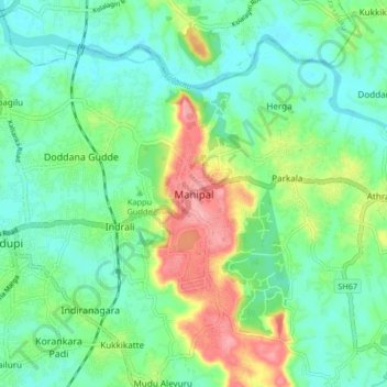
Naam: Topografische kaart Manipal, hoogte, reliëf.
Locatie: Manipal, Udupi taluku, Udupi, Karnataka, 576104, India (13.31197 74.74703 13.39197 74.82703)
Gemiddelde hoogte: 32 m
Minimale hoogte: -1 m
Maximale hoogte: 103 m
Andere topografische kaarten
Klik op een kaart om zijn topografie, zijn hoogte en zijn reliëf te bekijken.