
Topografische kaart Coalinga
Interactieve kaart
Klik op de kaart om de hoogte weer te geven.
Over deze kaart
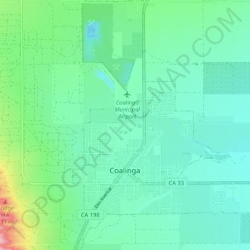
Naam: Topografische kaart Coalinga, hoogte, reliëf.
Locatie: Coalinga, Fresno County, California, United States (36.12052 -120.37562 36.18044 -120.32175)
Gemiddelde hoogte: 216 m
Minimale hoogte: 180 m
Maximale hoogte: 347 m
Coalinga is located 52 miles (84 km) southwest of Fresno, at an elevation of 673 feet (205 m). The topography is generally level, suitable for a number of field crops which do not require large amounts of water. It is located near the eastern foothills of the Diablo Range.