
Topografische kaart Kitty Hawk
Interactieve kaart
Klik op de kaart om de hoogte weer te geven.
Over deze kaart
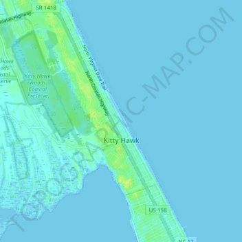
Naam: Topografische kaart Kitty Hawk, hoogte, reliëf.
Gemiddelde hoogte: 2 m
Minimale hoogte: -2 m
Maximale hoogte: 14 m
Kitty Hawk is located at 36°06′N 75°42′W / 36.1°N 75.7°W / 36.1; -75.7 at an elevation of 7 feet (2 m) above sea level.