
Topografische kaart Batanejos
Interactieve kaart
Klik op de kaart om de hoogte weer te geven.
Over deze kaart
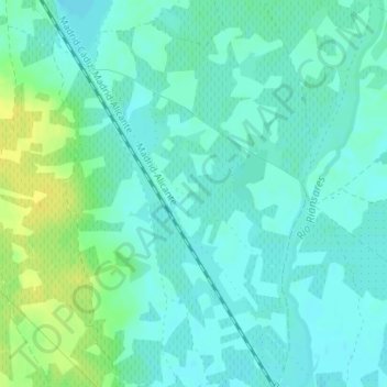
Naam: Topografische kaart Batanejos, hoogte, reliëf.
Locatie: Batanejos, Villacañas, Castilla-La Mancha, España (39.57093 -3.31806 39.59093 -3.29806)
Gemiddelde hoogte: 663 m
Minimale hoogte: 656 m
Maximale hoogte: 677 m
Andere topografische kaarten
Klik op een kaart om zijn topografie, zijn hoogte en zijn reliëf te bekijken.
Sierra Morena
España > Castilla-La Mancha > Villacañas
Sierra Morena, Villacañas, Toledo, Castilla-La Mancha, España
Gemiddelde hoogte: 700 m