
Topografische kaart DeBolt
Interactieve kaart
Klik op de kaart om de hoogte weer te geven.
Over deze kaart
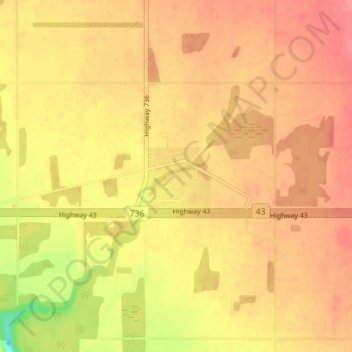
Naam: Topografische kaart DeBolt, hoogte, reliëf.
Gemiddelde hoogte: 644 m
Minimale hoogte: 599 m
Maximale hoogte: 664 m
DeBolt is located in Peace Country, 58 km (36 mi) east from Grande Prairie and 54 km (34 mi) west of Valleyview along Highway 43. It lies in the Smoky River valley, at an elevation of 640 m (2,100 ft).
Andere topografische kaarten
Klik op een kaart om zijn topografie, zijn hoogte en zijn reliëf te bekijken.
Musreau Lake
Canada > Alberta > Municipal District of Greenview
Musreau Lake, Municipal District of Greenview, Alberta, Canada
Gemiddelde hoogte: 889 m
Kakwa Mountain
Canada > Alberta > Municipal District of Greenview
Kakwa Mountain, Municipal District of Greenview, Alberta, Canada
Gemiddelde hoogte: 1.787 m
Little Smoky
Canada > Alberta > Municipal District of Greenview > Little Smoky
Little Smoky, Municipal District of Greenview, Alberta, Canada
Gemiddelde hoogte: 682 m