
Topografische kaart Saddle
Interactieve kaart
Klik op de kaart om de hoogte weer te geven.
Over deze kaart
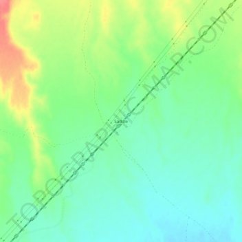
Naam: Topografische kaart Saddle, hoogte, reliëf.
Locatie: Saddle, Maricopa County, Arizona, United States (33.13782 -113.10018 33.17782 -113.06018)
Gemiddelde hoogte: 220 m
Minimale hoogte: 197 m
Maximale hoogte: 263 m
Saddle is a populated place situated in Maricopa County, Arizona, United States. It has an estimated elevation of 722 feet (220 m) above sea level. It is located on the Union Pacific Railroad's Phoenix Subdivision.