
Topografische kaart Weza Forest
Interactieve kaart
Klik op de kaart om de hoogte weer te geven.
Over deze kaart
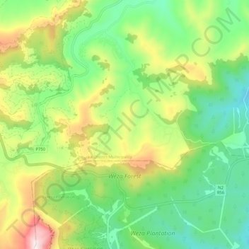
Naam: Topografische kaart Weza Forest, hoogte, reliëf.
Gemiddelde hoogte: 1.317 m
Minimale hoogte: 1.021 m
Maximale hoogte: 1.849 m
Andere topografische kaarten
Klik op een kaart om zijn topografie, zijn hoogte en zijn reliëf te bekijken.
aManzamnyama
RSA > KwaZulu-Natal > uMuziwabantu Local Municipality
aManzamnyama, uMuziwabantu Local Municipality, Ugu District Municipality, KwaZulu-Natal, RSA
Gemiddelde hoogte: 1.015 m