
Topografische kaart Lesedi Local Municipality
Interactieve kaart
Klik op de kaart om de hoogte weer te geven.
Over deze kaart
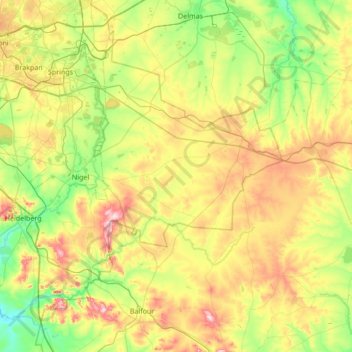
Naam: Topografische kaart Lesedi Local Municipality, hoogte, reliëf.
Gemiddelde hoogte: 1.613 m
Minimale hoogte: 1.487 m
Maximale hoogte: 1.841 m
Andere topografische kaarten
Klik op een kaart om zijn topografie, zijn hoogte en zijn reliëf te bekijken.
Vereeniging
South Africa > Gauteng > Sedibeng District Municipality > Vereeniging
Vereeniging, Emfuleni Local Municipality, Sedibeng District Municipality, Gauteng, 1939, South Africa
Gemiddelde hoogte: 1.475 m