
Topografische kaart Narok
Interactieve kaart
Klik op de kaart om de hoogte weer te geven.
Narok
Narok (sometimes referred to as Narok Town) is a town west of Nairobi that supports Kenya's economy in south-west of the country, along the Great Rift Valley. Narok is the district capital of the Narok County and stands as the major centre of commerce in the district. Narok has a population of around 40,000 people, mostly Maasai. The elevation of Narok is 1827 metres (5,997 feet) in altitude.
Over deze kaart
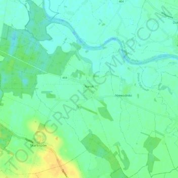
Naam: Topografische kaart Narok, hoogte, reliëf.
Locatie: Narok, gmina Dąbrowa, Opole County, Opole Voivodeship, Poland (50.70939 17.73250 50.77636 17.82572)
Gemiddelde hoogte: 149 m
Minimale hoogte: 141 m
Maximale hoogte: 166 m