
Topografische kaart Dandenong Ranges National Park - Ferntree Gully
Interactieve kaart
Klik op de kaart om de hoogte weer te geven.
Dandenong Ranges National Park - Ferntree Gully
The topography consists of a series of ridges dissected by deeply cut streams. Sheltered gullies in the south of the range are home to temperate rain forest, fern gullies and Mountain Ash forest Eucalyptus regnans, whereas the drier ridges and exposed northern slopes are covered by dry sclerophyll forest of stringybarks and box. The entire range is highly prone to bushfires, the most recent of which have been the 1983 Ash Wednesday bushfires, the 1997 Dandenong Ranges bushfires and small fires during the Black Saturday bushfires in 2009.
Over deze kaart
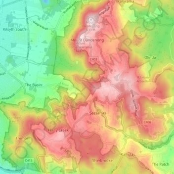
Naam: Topografische kaart Dandenong Ranges National Park - Ferntree Gully, hoogte, reliëf.
Gemiddelde hoogte: 345 m
Minimale hoogte: 67 m
Maximale hoogte: 621 m