
Topografische kaart Santa Fe Island
Interactieve kaart
Klik op de kaart om de hoogte weer te geven.
Over deze kaart
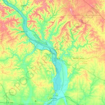
Naam: Topografische kaart Santa Fe Island, hoogte, reliëf.
Locatie: Santa Fe Island, Carroll County, Illinois, United States (41.80919 -90.51152 42.44919 -89.87152)
Gemiddelde hoogte: 238 m
Minimale hoogte: 174 m
Maximale hoogte: 369 m