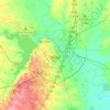
Topografische kaart China Spring
Klik op de kaart om de hoogte weer te geven.
China Spring
China Spring became the focus of a rural school district in the late 1920s. Two churches, a school, and many houses marked the community on topographic maps of the mid-1970s.
Over deze kaart

Naam: Topografische kaart China Spring, hoogte, reliëf.
Locatie: China Spring, McLennan County, Texas, 76633, United States (31.63215 -97.32782 31.67215 -97.28782)
Gemiddelde hoogte: 177 m
Minimale hoogte: 159 m
Maximale hoogte: 200 m
Andere topografische kaarten
Klik op een kaart om zijn topografie, zijn hoogte en zijn reliëf te bekijken.