
Topografische kaart Fish Creek
Interactieve kaart
Klik op de kaart om de hoogte weer te geven.
Over deze kaart
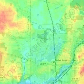
Naam: Topografische kaart Fish Creek, hoogte, reliëf.
Gemiddelde hoogte: 325 m
Minimale hoogte: 304 m
Maximale hoogte: 355 m
Andere topografische kaarten
Klik op een kaart om zijn topografie, zijn hoogte en zijn reliëf te bekijken.
Brecksville
United States of America > Ohio > Brecksville > Brecksville
Brecksville, Cuyahoga County, Ohio, 44141, United States of America
Gemiddelde hoogte: 292 m
Allen County
United States of America > Ohio
Allen County, Ohio, United States of America
Gemiddelde hoogte: 264 m
Scioto County
United States of America > Ohio
Scioto County, Ohio, United States of America
Gemiddelde hoogte: 245 m
Summerland Beach
United States of America > Ohio > Millersport > Summerland Beach
Summerland Beach, Millersport, Fairfield, Ohio, 43046, United States of America
Gemiddelde hoogte: 279 m
Gordon
United States of America > Ohio > Gordon
Gordon, Darke County, Ohio, United States of America
Gemiddelde hoogte: 317 m
Pines Cottage Area
United States of America > Ohio > Pines Cottage Area
Pines Cottage Area, Orange Township, Carroll County, Ohio, 44639, United States of America
Gemiddelde hoogte: 320 m
Crystal Park
United States of America > Ohio > Canton > Crystal Park
Crystal Park, Canton, Stark County, Ohio, 44705, United States of America
Gemiddelde hoogte: 331 m
Graytown
United States of America > Ohio > Graytown
Graytown, Benton Township, Ottawa County, Ohio, 43432, United States of America
Gemiddelde hoogte: 182 m
New Miami
United States of America > Ohio > New Miami > New Miami
New Miami, St. Clair Township, Butler County, Ohio, United States of America
Gemiddelde hoogte: 188 m