
Topografische kaart Parc national des Chutes d'Augrabies
Interactieve kaart
Klik op de kaart om de hoogte weer te geven.
Over deze kaart
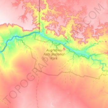
Naam: Topografische kaart Parc national des Chutes d'Augrabies, hoogte, reliëf.
Gemiddelde hoogte: 732 m
Minimale hoogte: 422 m
Maximale hoogte: 970 m