
Topografische kaart Pabineau Falls
Interactieve kaart
Klik op de kaart om de hoogte weer te geven.
Over deze kaart
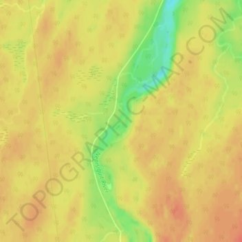
Naam: Topografische kaart Pabineau Falls, hoogte, reliëf.
Gemiddelde hoogte: 47 m
Minimale hoogte: 14 m
Maximale hoogte: 62 m
Andere topografische kaarten
Klik op een kaart om zijn topografie, zijn hoogte en zijn reliëf te bekijken.
Chamberlain Settlement
Canada > New Brunswick > Bathurst Parish
Chamberlain Settlement, Bathurst Parish, Gloucester County, New Brunswick, E2A 3Z2, Canada
Gemiddelde hoogte: 46 m
Bathurst
Canada > New Brunswick > Bathurst Parish
Bathurst, Bathurst Parish, Gloucester County, New Brunswick, Canada
Gemiddelde hoogte: 26 m