
Topografische kaart Alfred
Interactieve kaart
Klik op de kaart om de hoogte weer te geven.
Alfred
The elevation of Alfred is about 1,700 feet (520 m) but rises to a high point of 2,355 feet (718 m) at the summit of Jericho Hill just south of the village. The hills greatly affect the weather in the region, which results in quick changes as well as different conditions in neighboring valleys.
Over deze kaart
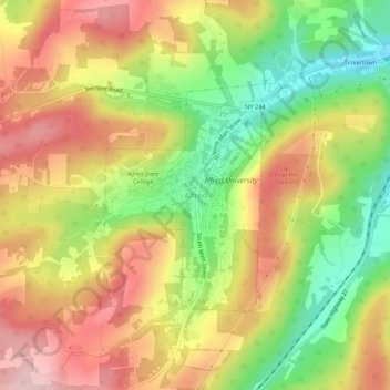
Naam: Topografische kaart Alfred, hoogte, reliëf.
Gemiddelde hoogte: 604 m
Minimale hoogte: 484 m
Maximale hoogte: 712 m