
Topografische kaart Lachung
Interactieve kaart
Klik op de kaart om de hoogte weer te geven.
Lachung
Lachung is a town and hill station in northeast Sikkim, India. It is located in the North Sikkim district near the border with Tibet. Lachung is at an elevation of about 9,600 feet (2,900 m) and at the confluence of the Lachen and Lachung Rivers, both tributaries of the River Teesta. The word Lachung means "small pass". The town is approximately 125 kilometres (78 mi) from the capital Gangtok.
Over deze kaart
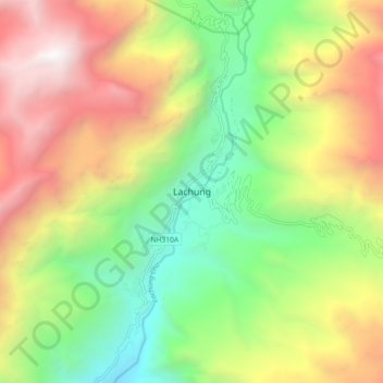
Naam: Topografische kaart Lachung, hoogte, reliëf.
Locatie: Lachung, Chungthang, Mangan, Sikkim, India (27.64971 88.70259 27.72971 88.78259)
Gemiddelde hoogte: 3.617 m
Minimale hoogte: 2.281 m
Maximale hoogte: 5.366 m
Andere topografische kaarten
Klik op een kaart om zijn topografie, zijn hoogte en zijn reliëf te bekijken.