
Topografische kaart Dhand
Interactieve kaart
Klik op de kaart om de hoogte weer te geven.
Over deze kaart
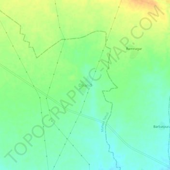
Naam: Topografische kaart Dhand, hoogte, reliëf.
Locatie: Dhand, Mahwa Tehsil, Dausa District, Rajasthan, India (26.88204 77.03395 26.92204 77.07395)
Gemiddelde hoogte: 224 m
Minimale hoogte: 210 m
Maximale hoogte: 241 m
Andere topografische kaarten
Klik op een kaart om zijn topografie, zijn hoogte en zijn reliëf te bekijken.
Maujpur
India > Rajasthan > Mahwa Tehsil
Maujpur, Mahwa Tehsil, Dausa District, Rajasthan, India
Gemiddelde hoogte: 242 m