
Topografische kaart Thayne
Interactieve kaart
Klik op de kaart om de hoogte weer te geven.
Over deze kaart
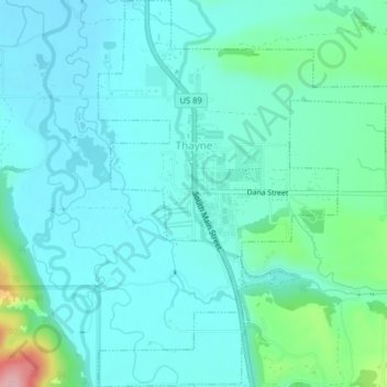
Naam: Topografische kaart Thayne, hoogte, reliëf.
Locatie: Thayne, Lincoln County, Wyoming, United States (42.90253 -111.01238 42.93177 -110.97281)
Gemiddelde hoogte: 1.814 m
Minimale hoogte: 1.783 m
Maximale hoogte: 1.961 m
Thayne is located at 42°55′11″N 111°0′3″W / 42.91972°N 111.00083°W / 42.91972; -111.00083 (42.919754, -111.000714), at 5906 feet in elevation. It sits in the northern portion of Wyoming's grassy Star Valley, close to the Salt River. Thayne is surrounded by green grassland and ranches, with forested mountains at the valley's edge.