
Topografische kaart Lugu Lake
Interactieve kaart
Klik op de kaart om de hoogte weer te geven.
Over deze kaart
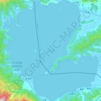
Naam: Topografische kaart Lugu Lake, hoogte, reliëf.
Gemiddelde hoogte: 2.750 m
Minimale hoogte: 2.686 m
Maximale hoogte: 3.608 m
Lugu Lake (simplified Chinese: 泸沽湖; traditional Chinese: 瀘沽湖; pinyin: Lúgū Hú) is located in the northwest of the Yunnan plateau, with the middle of the lake forming the border between the Ninglang County of Yunnan Province and the Yanyuan County of Sichuan Province. The formation of the lake is thought to have occurred in a geological fault belonging to the geological age of the Late Cenozoic. It is an alpine lake at an elevation of 2,685 metres (8,809 ft) and is the highest lake in the Yunnan Province. The lake is surrounded by mountains and has five islands, four peninsulas, fourteen bays and seventeen beaches.