
Topografische kaart Ladice
Interactieve kaart
Klik op de kaart om de hoogte weer te geven.
Ladice
The municipality lies at an altitude of 209 m (686 ft) and covers an area of 11.648 km2 (4.497 sq mi). It has a population of about 800 people.
Over deze kaart
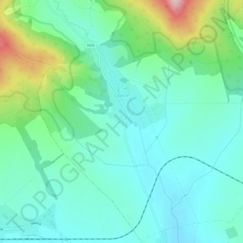
Naam: Topografische kaart Ladice, hoogte, reliëf.
Gemiddelde hoogte: 240 m
Minimale hoogte: 177 m
Maximale hoogte: 440 m