
Topografische kaart Painter
Interactieve kaart
Klik op de kaart om de hoogte weer te geven.
Over deze kaart
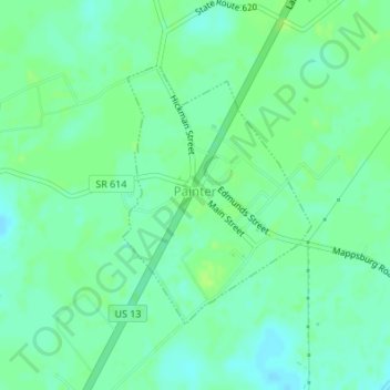
Naam: Topografische kaart Painter, hoogte, reliëf.
Locatie: Painter, Accomack County, Virginia, United States (37.57621 -75.79126 37.59410 -75.77476)
Gemiddelde hoogte: 10 m
Minimale hoogte: 4 m
Maximale hoogte: 16 m
It lies at an elevation of 36 feet.
Andere topografische kaarten
Klik op een kaart om zijn topografie, zijn hoogte en zijn reliëf te bekijken.
Deep Creek
United States > Virginia > Accomack County
Deep Creek, Accomack County, Virginia, United States
Gemiddelde hoogte: 1 m
Assawoman Island
United States > Virginia > Accomack County
Assawoman Island, Accomack County, Virginia, United States
Gemiddelde hoogte: 2 m
Upper Tump
United States > Virginia > Accomack County
Upper Tump, Accomack County, Virginia, United States
Gemiddelde hoogte: 0 m
Onancock
United States > Virginia > Accomack County
Onancock, Accomack County, Virginia, United States
Gemiddelde hoogte: 6 m
McClean Gut
United States > Virginia > Accomack County > Cedar View
McClean Gut, Cedar View, Accomack County, Virginia, United States
Gemiddelde hoogte: 2 m
Tangier
United States > Virginia > Accomack County > Tangier
Tangier, Accomack County, Virginia, 23440, United States
Gemiddelde hoogte: 0 m