
Topografische kaart Upper Tump
Interactieve kaart
Klik op de kaart om de hoogte weer te geven.
Over deze kaart
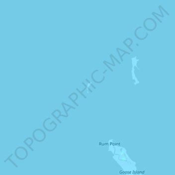
Naam: Topografische kaart Upper Tump, hoogte, reliëf.
Locatie: Upper Tump, Accomack County, Virginia, United States (37.87993 -76.01253 37.88171 -76.01148)
Gemiddelde hoogte: 0 m
Minimale hoogte: -2 m
Maximale hoogte: 1 m
Andere topografische kaarten
Klik op een kaart om zijn topografie, zijn hoogte en zijn reliëf te bekijken.
Deep Creek
United States > Virginia > Accomack County
Deep Creek, Accomack County, Virginia, United States
Gemiddelde hoogte: 1 m
Assawoman Island
United States > Virginia > Accomack County
Assawoman Island, Accomack County, Virginia, United States
Gemiddelde hoogte: 2 m
Onancock
United States > Virginia > Accomack County
Onancock, Accomack County, Virginia, United States
Gemiddelde hoogte: 6 m
McClean Gut
United States > Virginia > Accomack County > Cedar View
McClean Gut, Cedar View, Accomack County, Virginia, United States
Gemiddelde hoogte: 2 m
Tangier
United States > Virginia > Accomack County > Tangier
Tangier, Accomack County, Virginia, 23440, United States
Gemiddelde hoogte: 0 m
Painter
United States > Virginia > Accomack County
Painter, Accomack County, Virginia, United States
Gemiddelde hoogte: 10 m