
Topografische kaart State of Georgia
Interactieve kaart
Klik op de kaart om de hoogte weer te geven.
Over deze kaart
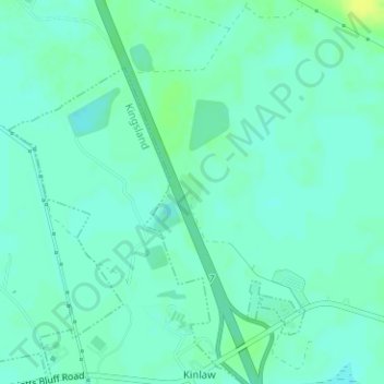
Naam: Topografische kaart State of Georgia, hoogte, reliëf.
Locatie: State of Georgia, Camden County, Georgia, United States (30.85623 -81.67740 30.85885 -81.67526)
Gemiddelde hoogte: 6 m
Minimale hoogte: -1 m
Maximale hoogte: 16 m
Andere topografische kaarten
Klik op een kaart om zijn topografie, zijn hoogte en zijn reliëf te bekijken.
Mount Storm
United States > Georgia > Camden County
Mount Storm, Camden County, Georgia, 31548, United States
Gemiddelde hoogte: 7 m
Beach Creek
United States > Georgia > Camden County > Dungeness
Beach Creek, Dungeness, Camden County, Georgia, United States
Gemiddelde hoogte: 1 m
Cumberland Island National Seashore
United States > Georgia > Camden County > St. Marys
Cumberland Island National Seashore, St. Marys, Camden County, Georgia, United States
Gemiddelde hoogte: 1 m
St. Marys
United States > Georgia > Camden County > St. Marys
St. Marys, Camden County, Georgia, United States
Gemiddelde hoogte: 3 m
Kingsland
United States > Georgia > Camden County > Kingsland
Kingsland, Camden County, Georgia, 31548, United States
Gemiddelde hoogte: 6 m
Kingsland
United States > Georgia > Camden County
Kingsland, Camden County, Georgia, 31548, United States
Gemiddelde hoogte: 5 m