
Topografische kaart Whetstone
Interactieve kaart
Klik op de kaart om de hoogte weer te geven.
Over deze kaart
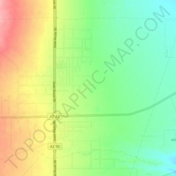
Naam: Topografische kaart Whetstone, hoogte, reliëf.
Locatie: Whetstone, Cochise County, Arizona, United States (31.67644 -110.38287 31.73135 -110.30153)
Gemiddelde hoogte: 1.324 m
Minimale hoogte: 1.278 m
Maximale hoogte: 1.394 m
Andere topografische kaarten
Klik op een kaart om zijn topografie, zijn hoogte en zijn reliëf te bekijken.
Chiricahua National Monument
United States > Arizona > Cochise County
Chiricahua National Monument, Cochise County, Arizona, United States
Gemiddelde hoogte: 1.861 m
Willcox
United States > Arizona > Cochise County
Willcox, Cochise County, Arizona, 85643, United States
Gemiddelde hoogte: 1.274 m
Bakerville
United States > Arizona > Cochise County > Bisbee > Warren
Bakerville, Warren, Bisbee, Cochise County, Arizona, 85603, United States
Gemiddelde hoogte: 1.579 m
Douglas
United States > Arizona > Cochise County > Douglas
Douglas, Cochise County, Arizona, United States
Gemiddelde hoogte: 1.265 m
Cathedral Rock
United States > Arizona > Cochise County
Cathedral Rock, Cochise County, Arizona, United States
Gemiddelde hoogte: 1.774 m
Sierra Vista
United States > Arizona > Cochise County
Sierra Vista, Cochise County, Arizona, United States
Gemiddelde hoogte: 1.507 m
Portal
United States > Arizona > Cochise County > Portal
Portal, Cochise County, Arizona, United States
Gemiddelde hoogte: 1.523 m
Bisbee
United States > Arizona > Cochise County
Bisbee, Cochise County, Arizona, United States
Gemiddelde hoogte: 1.676 m