Geolokaliseren

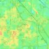
Topografische kaart Santos

Klik op de kaart om de hoogte weer te geven.

Over deze kaart

Naam: Topografische kaart Santos, hoogte, reliëf.

Locatie: Santos, Marion County, Florida, 34480, United States (29.08915 -82.11287 29.12915 -82.07287)

Gemiddelde hoogte: 26 m

Minimale hoogte: 13 m

Maximale hoogte: 49 m

Andere topografische kaarten

Klik op een kaart om zijn topografie, zijn hoogte en zijn reliëf te bekijken.
Ocala

United States > Florida > Marion County

Ocala features a varied terrain of rolling hills, gently undulating plains, and rich limestone formations typical of north-central Florida. The area rests at an elevation that generally ranges from around 50 to 150 feet above sea level, with pockets of higher ground providing scenic overlooks and natural…

Gemiddelde hoogte: 28 m
Lake Kerr

United States > Florida > Marion County > Salt Springs

Gemiddelde hoogte: 19 m

Belleview

United States > Florida > Marion County

Gemiddelde hoogte: 29 m

Dunnellon

United States > Florida > Marion County

Gemiddelde hoogte: 21 m

Reddick

United States > Florida > Marion County

Gemiddelde hoogte: 33 m

Ocala

United States > Florida > Marion County

Gemiddelde hoogte: 28 m

Ocala

United States > Florida > Marion County

Gemiddelde hoogte: 28 m

Belleview

United States > Florida > Marion County

Gemiddelde hoogte: 29 m

Lake Tuscawilla

United States > Florida > Marion County > Ocala

Gemiddelde hoogte: 31 m

Reddick

United States > Florida > Marion County

Gemiddelde hoogte: 33 m

Rust jezelf uit voor je volgende avontuur:

📦Rugzak Organizers - Slimme organizers voor backpacking
🏕️Bivak Uitrusting - Minimalistische uitrusting voor overnachten
🧢Outdoor Petten - Petten en mutsen voor zon- en koudebescherming
🧭Kompas - Betrouwbare kompassen voor navigatie in de natuur
🪢Paracord - Sterk touw voor outdoor en survival gebruik

Als Amazon-partner verdient deze site een commissie op in aanmerking komende aankopen, zonder extra kosten voor jou.