
Topografische kaart Tolleson
Interactieve kaart
Klik op de kaart om de hoogte weer te geven.
Over deze kaart
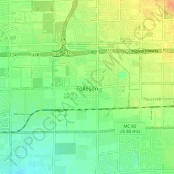
Naam: Topografische kaart Tolleson, hoogte, reliëf.
Locatie: Tolleson, Maricopa County, Arizona, United States (33.43563 -112.28998 33.46558 -112.22126)
Gemiddelde hoogte: 310 m
Minimale hoogte: 296 m
Maximale hoogte: 328 m
Andere topografische kaarten
Klik op een kaart om zijn topografie, zijn hoogte en zijn reliëf te bekijken.
Hollis Park
United States > Arizona > Maricopa County > Tempe
Hollis Park, Tempe, Maricopa County, Arizona, United States
Gemiddelde hoogte: 362 m
Peoria
United States > Arizona > Maricopa County
Peoria, Maricopa County, Arizona, United States
Gemiddelde hoogte: 505 m
Mesa
United States > Arizona > Maricopa County
Mesa, Maricopa County, Arizona, 85201, United States
Gemiddelde hoogte: 399 m
Youngtown
United States > Arizona > Maricopa County
Youngtown, Maricopa County, Arizona, 85363, United States
Gemiddelde hoogte: 341 m
Glendale
United States > Arizona > Maricopa County
Glendale, Maricopa County, Arizona, United States
Gemiddelde hoogte: 380 m
New River
United States > Arizona > Maricopa County > Phoenix
New River, Phoenix, Maricopa County, Arizona, United States
Gemiddelde hoogte: 690 m
Phoenix
United States > Arizona > Maricopa County
Phoenix, Maricopa County, Arizona, United States
Gemiddelde hoogte: 481 m
Mesa
United States > Arizona > Maricopa County
Mesa, Maricopa County, Arizona, United States
Gemiddelde hoogte: 385 m
Avondale
United States > Arizona > Maricopa County
Avondale, Maricopa County, Arizona, United States
Gemiddelde hoogte: 339 m
Litchfield Park
United States > Arizona > Maricopa County
Litchfield Park, Maricopa County, Arizona, United States
Gemiddelde hoogte: 319 m
Chandler
United States > Arizona > Maricopa County
Chandler, Maricopa County, Arizona, United States
Gemiddelde hoogte: 372 m
Tempe
United States > Arizona > Maricopa County
Tempe, Maricopa County, Arizona, United States
Gemiddelde hoogte: 370 m