
Topografische kaart San Andres
Interactieve kaart
Klik op de kaart om de hoogte weer te geven.
Over deze kaart
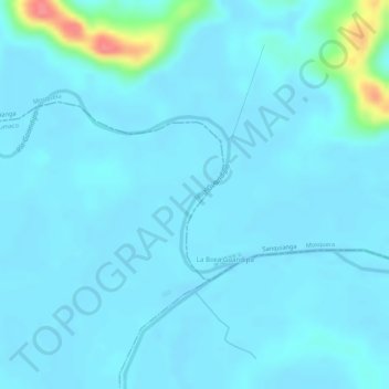
Naam: Topografische kaart San Andres, hoogte, reliëf.
Locatie: San Andres, Tumaco, Nariño, Colombia (2.27792 -78.50289 2.28871 -78.49893)
Gemiddelde hoogte: 9 m
Minimale hoogte: 0 m
Maximale hoogte: 77 m
Andere topografische kaarten
Klik op een kaart om zijn topografie, zijn hoogte en zijn reliëf te bekijken.
LA BRAVA - R?O GUANA
Colombia > Nariño > Tumaco > Kaunapi
LA BRAVA - R?O GUANA, Kaunapi, Tumaco, Pacífico Sur, Nariño, Colombia
Gemiddelde hoogte: 18 m
San Fransico (6)
Colombia > Nariño > Contadero > Contadero
San Fransico (6), Contadero, Ex-Providencia de Obando, Nariño, Colombia
Gemiddelde hoogte: 2.804 m