

Topografische kaart Nilles Corner
Klik op de kaart om de hoogte weer te geven.
Over deze kaart

Naam: Topografische kaart Nilles Corner, hoogte, reliëf.
Locatie: Nilles Corner, Douglas County, Washington, United States (47.98543 -119.42809 48.02543 -119.38809)
Gemiddelde hoogte: 688 m
Minimale hoogte: 659 m
Maximale hoogte: 752 m
Andere topografische kaarten
Klik op een kaart om zijn topografie, zijn hoogte en zijn reliëf te bekijken.
Waterville
United States > Washington > Douglas County
Waterville occupies a high, open position on the Waterville Plateau in central Douglas County, at about 2,622 feet (799 m) above sea level, where the town sits amid broad upland farmland rather than in a river valley. The surrounding terrain is gently rolling to moderately undulating, with shallow draws, low…
Gemiddelde hoogte: 807 m

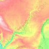
Moses Coulee
United States > Washington > Douglas County
Pleistocene glaciers advanced onto the Waterville Plateau, with the Okanogan Lobe of the Cordilleran Ice Sheet reaching as far south as the town of Withrow. Evidence for glaciation on the Waterville Plateau includes polished and striated bedrock, glacial erratics, drumlinoid topography, eskers, moraines,…
Gemiddelde hoogte: 666 m