
Topografische kaart Alligator River National Wildlife Refuge
Interactieve kaart
Klik op de kaart om de hoogte weer te geven.
Over deze kaart
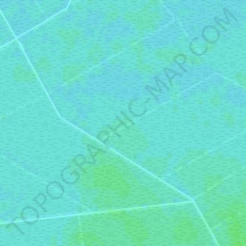
Naam: Topografische kaart Alligator River National Wildlife Refuge, hoogte, reliëf.
Gemiddelde hoogte: 2 m
Minimale hoogte: 0 m
Maximale hoogte: 7 m
Andere topografische kaarten
Klik op een kaart om zijn topografie, zijn hoogte en zijn reliëf te bekijken.
Emerald Isle
USA > North Carolina > Emerald Isle
Emerald Isle, Carteret County, North Carolina, 28594, USA
Gemiddelde hoogte: 1 m
South Mountain State Park
USA > North Carolina > Burkemont
South Mountain State Park, Watershed Road, Burkemont, Burke County, North Carolina, 28655, USA
Gemiddelde hoogte: 541 m
Pisgah National Forest
Pisgah National Forest, Caney Bottom Trail, Transylvania County, North Carolina, USA
Gemiddelde hoogte: 757 m
Osmond
USA > North Carolina > Osmond
Osmond, Caswell County, North Carolina, 27291, USA
Gemiddelde hoogte: 148 m
Benham
USA > North Carolina > Benham
Benham, Wilkes County, North Carolina, USA
Gemiddelde hoogte: 373 m
Eccles Park
USA > North Carolina > Eccles Park
Eccles Park, Cumberland County, North Carolina, 28301, USA
Gemiddelde hoogte: 54 m
Rangewood
USA > North Carolina > Rangewood
Rangewood, Orange County, North Carolina, 27516, USA
Gemiddelde hoogte: 152 m
Bull Creek
Bull Creek, Washington County, North Carolina, USA
Gemiddelde hoogte: 1 m
Clemmons
USA > North Carolina > Clemmons
Clemmons, Forsyth County, North Carolina, 27012, USA
Gemiddelde hoogte: 235 m
Running Creek
Running Creek, Stanly County, North Carolina, USA
Gemiddelde hoogte: 186 m
Bethania
USA > North Carolina > Bethania
Bethania, Forsyth County, North Carolina, 27010, USA
Gemiddelde hoogte: 258 m
Hatteras Island
Hatteras Island, Dare County, North Carolina, USA
Gemiddelde hoogte: 0 m
Millers Creek
Millers Creek, Duplin County, North Carolina, 28453, USA
Gemiddelde hoogte: 37 m
Hanging Rock State Park
USA > North Carolina > Moores Springs
Hanging Rock State Park, 1790, Moores Springs, Stokes County, North Carolina, 27016, USA
Gemiddelde hoogte: 350 m
Samaria
USA > North Carolina > Samaria
Samaria, Nash County, North Carolina, USA
Gemiddelde hoogte: 76 m
Little Run
Little Run, Carteret County, North Carolina, USA
Gemiddelde hoogte: 10 m
Dryman Mountain
USA > North Carolina > Woodfin
Dryman Mountain, Woodfin, Buncombe County, North Carolina, 28806, USA
Gemiddelde hoogte: 678 m
Linville
USA > North Carolina > Linville
Linville, Avery County, North Carolina, 28646, USA
Gemiddelde hoogte: 1.178 m
Appalachians
Appalachians, Yancey County, North Carolina, USA
Gemiddelde hoogte: 1.463 m
Pheasant Creek
Pheasant Creek, Surry County, North Carolina, USA
Gemiddelde hoogte: 329 m
Silver Lake
Silver Lake, Ocracoke, Hyde County, North Carolina, 27960, USA
Gemiddelde hoogte: 1 m
Webbs Creek
Webbs Creek, Rutherford County, North Carolina, 28019, USA
Gemiddelde hoogte: 258 m
Cedar Bay
USA > North Carolina > Cedar Bay
Cedar Bay, Brunswick County, North Carolina, 28467, USA
Gemiddelde hoogte: 10 m
Eagleton
USA > North Carolina > Eagleton
Eagleton, Dare County, North Carolina, 27948, USA
Gemiddelde hoogte: 1 m
Royal Park
USA > North Carolina > Royal Park
Royal Park, Davidson County, North Carolina, 27292-5243, USA
Gemiddelde hoogte: 232 m
Ski Lake
USA > North Carolina > Greensboro
Ski Lake, Carlson Dairy Road, Greensboro, Guilford County, North Carolina, 27410-8395, USA
Gemiddelde hoogte: 254 m
Mount Clark
Mount Clark, Swain County, North Carolina, USA
Gemiddelde hoogte: 957 m
Mitchell River
Mitchell River, Surry County, North Carolina, USA
Gemiddelde hoogte: 415 m
Southern Nantahala Wilderness
Southern Nantahala Wilderness, Appalachian Trail, Macon County, North Carolina, USA
Gemiddelde hoogte: 957 m
Lower Creek
USA > North Carolina > Lenoir
Lower Creek, Lenoir, Caldwell County, North Carolina, 28645, USA
Gemiddelde hoogte: 359 m
Mount Hardy
Mount Hardy, Haywood County, North Carolina, USA
Gemiddelde hoogte: 1.614 m