
Topografische kaart Gunnison
Interactieve kaart
Klik op de kaart om de hoogte weer te geven.
Over deze kaart
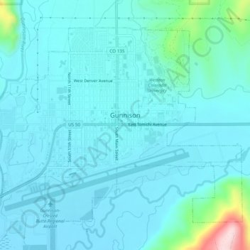
Naam: Topografische kaart Gunnison, hoogte, reliëf.
Locatie: Gunnison, Gunnison County, Colorado, United States (38.52956 -106.95098 38.55905 -106.90267)
Gemiddelde hoogte: 2.369 m
Minimale hoogte: 2.332 m
Maximale hoogte: 2.633 m
Also in 1880, the cattle industry in Gunnison was established. Realizing the poor conditions for farming (with only about eleven inches of rainfall annually and the short growing season due to the high elevation and alpine environment) the local farmers turned to ranching and began breeding cattle. To do this effectively, they had to clear and level fields for grazing purposes. Irrigation ditches also had to be cut into the ground to properly irrigate the fields in order to grow hay for the horses and cattle. Many of these practices are still in use, which can be seen while driving through and around the town to the various ranches that are still in operation.
Andere topografische kaarten
Klik op een kaart om zijn topografie, zijn hoogte en zijn reliëf te bekijken.
Almont
United States > Colorado > Gunnison County
Almont, Gunnison County, Colorado, 81210, United States
Gemiddelde hoogte: 2.578 m
Gothic Mountain
United States > Colorado > Gunnison County
Gothic Mountain, Gunnison County, Colorado, United States
Gemiddelde hoogte: 3.297 m
Whitepine
United States > Colorado > Gunnison County
Whitepine, Gunnison County, Colorado, United States
Gemiddelde hoogte: 3.202 m
Buck Mesa
United States > Colorado > Gunnison County
Buck Mesa, Gunnison County, Colorado, United States
Gemiddelde hoogte: 2.846 m
Crystal
United States > Colorado > Gunnison County
Crystal, Gunnison County, Colorado, United States
Gemiddelde hoogte: 3.146 m
Crested Butte
United States > Colorado > Gunnison County
Crested Butte, Gunnison County, Colorado, 81224, United States
Gemiddelde hoogte: 2.798 m
Marble
United States > Colorado > Gunnison County
Marble, Gunnison County, Colorado, United States
Gemiddelde hoogte: 2.611 m
Copper Mountain
United States > Colorado > Gunnison County
Copper Mountain, Gunnison County, Colorado, 81241, United States
Gemiddelde hoogte: 3.073 m
Floresta
United States > Colorado > Gunnison County
Floresta, Gunnison County, Colorado, United States
Gemiddelde hoogte: 3.110 m
Granite Basin
United States > Colorado > Gunnison County
Granite Basin, Gunnison County, Colorado, United States
Gemiddelde hoogte: 3.203 m
Tincup
United States > Colorado > Gunnison County > Tincup
Tincup, Gunnison County, Colorado, United States
Gemiddelde hoogte: 3.220 m
Sapinero
United States > Colorado > Gunnison County
Sapinero, Gunnison County, Colorado, 81247, United States
Gemiddelde hoogte: 2.340 m