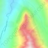
Topografische kaart Kathiawar
Klik op de kaart om de hoogte weer te geven.
Over deze kaart

Naam: Topografische kaart Kathiawar, hoogte, reliëf.
Locatie: Kathiawar, India (20.69029 68.93625 23.14989 72.57177)
Gemiddelde hoogte: 46 m
Minimale hoogte: -1 m
Maximale hoogte: 868 m
Andere topografische kaarten
Klik op een kaart om zijn topografie, zijn hoogte en zijn reliëf te bekijken.
Lucknow
India > Uttar Pradesh > Lucknow
Lucknow stands at an elevation of approximately 123 metres (404 ft) above sea level. The city had an area of 402 km2 (155 square miles) until December 2019, when 88 villages were added to the municipal limits and the area increased to 631 km2 (244 square miles). Bounded on the east by Barabanki, on the west by…
Gemiddelde hoogte: 120 m
Maharashtra
Maharashtra is the third largest state by area in India. The Western Ghats better known as Sahyadri, are a hilly range running parallel to the coast, at an average elevation of 1,200 metres (4,000 ft). Kalsubai, a peak in the Sahyadris, near Nashik city is the highest elevated point in Maharashtra. To the west…
Gemiddelde hoogte: 478 m
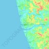
Mangaluru
India > Karnataka > Mangaluru taluk
Mangalore is also the administrative headquarters of the Dakshina Kannada district; it is a commercial, industrial, educational, healthcare, and startup hub. The city's international airport is the second-largest and second-busiest airport in Karnataka. Mangalore City Corporation is responsible for the civic…
Gemiddelde hoogte: 25 m
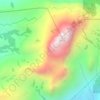
Western Ghats
The range starts near south of the Tapti river and runs approximately 1,600 km (990 mi) through the states of Gujarat, Maharashtra, Karnataka, Goa, Kerala and Tamil Nadu ending at Marunthuvazh Malai, Swamithope near the southern tip of India. These hills cover 160,000 km2 (62,000 sq mi) and form the catchment…
Gemiddelde hoogte: 2.225 m

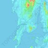
Mumbai
Mumbai lies at the mouth of the Ulhas River on the western coast of India, in the coastal region known as the Konkan. It sits on Salsette Island (Sashti Island), which it partially shares with the Thane district. Mumbai is bounded by the Arabian Sea to the west. Many parts of the city lie just above sea level,…
Gemiddelde hoogte: 13 m

Keylang
India > Himachal Pradesh > Lahaul
Kyelang is accessible from Manali via the Manali-Leh Highway, a part of NH21. It is located about 71 km (44 mi) north of Manali at an altitude of 3,080 m (10,100 ft) and used to remain cut off from the outside world for six months from late October to mid-May due to heavy snowfall at Rohtang pass until the…
Gemiddelde hoogte: 3.823 m
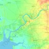
Surat
India > Gujarat > Katargam Taluka > Surat
Surat is a port city situated on the banks of the Tapi river. Damming of the Tapi caused the original port facilities to close; the nearest port is now in the Magadalla and Hazira area of Surat Metropolitan Region.It has famous beach called 'Dumas Beach' located in Hazira. The city is located at 21°10′N…
Gemiddelde hoogte: 11 m
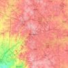
Bengaluru
India > Karnataka > Bangalore North
Bengaluru lies in the southeast of the South Indian state of Karnataka in the heart of the Mysore Plateau (a region of the larger Deccan Plateau) at an average elevation of 900 m (2,953 ft). The city covers an area of 741 km2 (286 sq mi). The Bengaluru metropolitan region covers an area of 7,005 km2 (2,705 sq…
Gemiddelde hoogte: 879 m
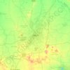
Indore
India > Madhya Pradesh > Juni Indore Tahsil
Indore /ɪnˈdɔːr/ (listen) is the most populous and the largest city in the Indian state of Madhya Pradesh. It serves as the headquarters of both Indore District and Indore Division. It is also considered as an education hub of the state and has campuses of both the Indian Institute of Technology and the…
Gemiddelde hoogte: 555 m

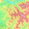
Shimla
Shimla is on the south-western ranges of the Himalayas at 31°37′N 77°06′E / 31.61°N 77.10°E / 31.61; 77.10. It has an average altitude of 2,206 metres (7,238 ft) above mean sea level and extends along a ridge with seven spurs. The city stretches nearly 9.2 kilometres (5.7 mi) from east to west.
Gemiddelde hoogte: 1.557 m
Lucknow
India > Uttar Pradesh > Lucknow
The city stands at an elevation of approximately 123 metres (404 ft) above sea level. Lucknow city had an area of 402 km2 (155 square miles) till December 2019, when 88 villages were added to the municipal limits and the area increased to 631 km2 (244 square miles). Bounded on the east by Barabanki, on the…
Gemiddelde hoogte: 120 m
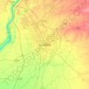
Vadodara
India > Gujarat > Vadodara Rural Taluka
Vadodara is located at 22°18′N 73°11′E / 22.30°N 73.19°E / 22.30; 73.19 in western India at an elevation of 39 metres (128 ft). It is the tenth-largest city in India with an area of 400 square kilometres (150 sq mi) and a population of 3.5 million, according to the 2010–11 census. The city…
Gemiddelde hoogte: 36 m



Udaipur
India > Rajasthan > Girwa Tehsil
Udaipur is located at 24°31′30″N 73°40′38″E / 24.525049°N 73.677116°E / 24.525049; 73.677116. The city covers an area of 64 km2 (25 sq mi) and lies at an altitude of 598.00 m (1,962 ft) above sea level. It is located in the southern region of Rajasthan, near the Gujarat border. The city…
Gemiddelde hoogte: 656 m
Amravati
India > Maharashtra > Amravati
Amravati is located at 20°56′N 77°45′E / 20.93°N 77.75°E / 20.93; 77.75. It has an average elevation of 343 meters (1125 feet). It lies 156 km (97 mi) west of Nagpur and serves as the administrative centre of Amravati District and of Amravati Division. The city is located near the passes…
Gemiddelde hoogte: 345 m
Varanasi
India > Uttar Pradesh > Sadar
Varanasi is located at an elevation of 80.71 metres (264.8 ft) in the centre of the Ganges valley of North India, in the Eastern part of the state of Uttar Pradesh, along the left crescent-shaped bank of the Ganges, averaging between 15 metres (50 ft) and 21 metres (70 ft) above the river. The city is the…
Gemiddelde hoogte: 77 m







Chennai
Chennai is located on the south–eastern coast of India in the north–eastern part of Tamil Nadu on a flat coastal plain known as the Eastern Coastal Plains. Its average elevation is around 6.7 metres (22 ft), and its highest point is 60 m (200 ft). Chennai is 2,184 kilometres (1,357 mi) south of Delhi,…
Gemiddelde hoogte: 7 m


Kanakapura
India > Karnataka > Kanakapura taluk
Kanakapura is located at 12°33′N 77°25′E / 12.55°N 77.42°E / 12.55; 77.42. It has an average elevation of 638 metres (2093 feet).
Gemiddelde hoogte: 663 m
Thiruvananthapuram
India > Kerala > Thiruvananthapuram
Thiruvananthapuram is built on seven hills by the seashore and is at 8°30′N 76°54′E / 8.5°N 76.9°E / 8.5; 76.9 on the west coast, near the southern tip of mainland India. The city is on the west coast of India and is bounded by the Laccadive Sea to its west and the Western Ghats to its east.…
Gemiddelde hoogte: 33 m

Kolkata
Spread roughly north–south along the east bank of the Hooghly River, Kolkata sits within the lower Ganges Delta of eastern India approximately 75 km (47 mi) west of the international border with Bangladesh; the city's elevation is 1.5–9 m (5–30 ft). Much of the city was originally a wetland that was…
Gemiddelde hoogte: 5 m
Junagadh
India > Gujarat > Junagadh City Taluka
Junagadh city is located at 21°31′N 70°28′E / 21.52°N 70.47°E / 21.52; 70.47 at the foot of Mount Girnar, with the Arabian sea to the southwest, Rajkot to the north, and Amreli to the east. It has an average elevation of 107 metres (351 ft).
Gemiddelde hoogte: 140 m


Kanpur
India > Uttar Pradesh > Kanpur
Situated in the flat Indo-Gangetic Plains, Kanpur has an average elevation of 318 metres (1,043 ft) above sea level. The Ganga flows by the city and several ghats are located on its banks, notably the Sati Chaura Ghat and Sarsaiya Ghat. The Brahmavart Ghat located at Bithoor (25 km northwards) is another ghat…
Gemiddelde hoogte: 124 m

Dharapuram
India > Tamil Nadu > Dharapuram
Dharapuram is located at 10°44′N 77°31′E / 10.73°N 77.52°E / 10.73; 77.52. Dharapuram town is situated along of the bank of Amaravathi River which flows from the south to north. Uppar River and dam, Nallathankal River and dam, Palar join the river Amaravathi. It has an average elevation of 45…
Gemiddelde hoogte: 252 m

Kumbakonam
India > Tamil Nadu > Kumbakonam
Kumbakonam is located at 10°58′N 79°25′E / 10.97°N 79.42°E / 10.97; 79.42. It is situated 273 km (170 mi) south of Chennai, 96 km (60 mi) east of Tiruchirappalli, about 40 km (25 mi) north-east of Thanjavur., and about 35 km (22 mi) south-west of Mayiladuthurai. It lies in the region called…
Gemiddelde hoogte: 27 m


Eastern Ghats
India > Odisha > Ramagiri > Burakhat
The Eastern Ghats is a mountain range that stretches 1,750 km (1,090 mi) along the eastern coast of the Indian peninsula. Covering an area of 75,000 km2 (29,000 sq mi), it traverses the states of Odisha, Telangana, Andhra Pradesh, Karnataka, and Tamil Nadu. The range forms a discontinuous chain of mountains…
Gemiddelde hoogte: 1.130 m
Surat
India > Gujarat > Katargam Taluka
Surat is a port city situated on the banks of the Tapi river. After dams were built, water flow in Tapi deceased causing the original port facilities to close. The nearest port is now in the Magadalla and Hazira area of Surat Metropolitan Region. It has a famous beach called 'Dumas Beach' located in Dumas.The…
Gemiddelde hoogte: 13 m




Bhubaneshwar
India > Odisha > Bhubaneswar (M.Corp.)
Bhubaneswar is in Khordha district of Odisha. It is in the eastern coastal plains, along the axis of the Eastern Ghats mountains. The city has an average altitude of 45 m (148 ft) above sea level. It lies southwest of the Mahanadi River that forms the northern boundary of Bhubaneswar metropolitan area, within…
Gemiddelde hoogte: 30 m

Nashik
India > Maharashtra > Nashik Subdistrict
The city's tropical location and high altitude combine to give it a relatively mild version of a tropical wet and dry climate (Köppen Aw). Temperatures rise slightly in October, but this is followed by the cool season from November to February. The cool season sees warm temperatures of around 28 °C or 82.4…
Gemiddelde hoogte: 631 m



Tiruvannamalai
India > Tamil Nadu > Tiruvannamalai > Tiruvannamalai
Located on the foothills of Annamalai hills, Tiruvannamalai has been ruled by the Pallavas, the Medieval Cholas, the Later Cholas, Hoysalas, the Vijayanagar Empire, the Carnatic kingdom, Tipu Sultan, and the British. It served as the capital of the Hoysalas. The town is built around the Annamalaiyar Temple…
Gemiddelde hoogte: 202 m
Leh
Leh (/ˈlɛ/) (Ladakhi: གླེ) is the joint capital and largest city of Ladakh, a union territory of India. Leh, located in the Leh district, was also the historical capital of the Kingdom of Ladakh, the seat of which was in the Leh Palace, the former residence of the royal family of Ladakh, built in the…
Gemiddelde hoogte: 4.294 m
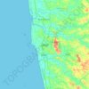
Udupi
India > Karnataka > Udupi taluku
Udupi has an elevation of 27 m (89 ft) above mean sea level. The climate in Udupi is hot in summers and pleasant in winter. During summers (from March to May) the temperature reaches up to 38 °C (100 °F) and in winters (from December to February) it is usually between 32 and 20 °C (90 and 68 °F). As it is…
Gemiddelde hoogte: 17 m
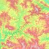
Almora
India > Uttarakhand > Almora
Almora is located at 29°35′50″N 79°39′33″E / 29.5971°N 79.6591°E / 29.5971; 79.6591 in Almora district in Uttarakhand. Almora is situated 365 km north-east the national capital New Delhi and 415 km south-east the state capital Dehradun. It lies in the revenue Division Kumaon and is located…
Gemiddelde hoogte: 1.557 m


Haldia
India > West Bengal > Haldia
Haldia is located at 22°02′N 88°04′E / 22.03°N 88.06°E / 22.03; 88.06. It has an average elevation of 8 metres (26 ft).
Gemiddelde hoogte: 3 m


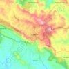
Madikeri
India > Karnataka > Madikeri taluku
Madikeri features a tropical highland climate as it has an elevation of 1,170 m (3,840 ft). Madikeri is located at 12°25′N 75°44′E / 12.42°N 75.73°E / 12.42; 75.73. Madikeri lies in the Western Ghats and is a popular hill station. The nearest cities are Hassan to the north, Mangaluru to the…
Gemiddelde hoogte: 1.054 m
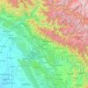
Bhuj
India > Gujarat > Bhuj Taluka
Bhuj has an average elevation of 110 metres (360 feet). On the eastern side of the city is a hill known as Bhujia Hill, on which there is a Bhujia Fort, that separates Bhuj city and Madhapar town ( considered one of the richest villages in Asia ). It has two lakes namely Hamirsar and Deshadsar (દેેેશળસર).
Gemiddelde hoogte: 130 m
Guwahati
Professor Abani Kumar Bhagawati of Gauhati University stated that since before there were sufficient wetlands to absorb rainwater and channels to carry excess water to the Brahmaputra, the city did not experience floods. However, human interference has disrupted the natural topography, leading to the current…
Gemiddelde hoogte: 113 m