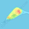
Topografische kaart Contractors Point
Klik op de kaart om de hoogte weer te geven.
Over deze kaart

Naam: Topografische kaart Contractors Point, hoogte, reliëf.
Gemiddelde hoogte: 18 m
Minimale hoogte: 0 m
Maximale hoogte: 150 m
Andere topografische kaarten
Klik op een kaart om zijn topografie, zijn hoogte en zijn reliëf te bekijken.
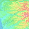
Hoh River
United States > Washington > Jefferson County
The Hoh River Trail, managed by the National Park Service, begins at the national park's Hoh Rain Forest Visitor Center at the end of the Upper Hoh Road. The trail follows the Hoh River east into the heart of the park. After 17.5 mi (28.2 km) it reaches Glacier Meadows near Mount Olympus's Blue Glacier. The…
Gemiddelde hoogte: 534 m
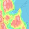

Quimper Peninsula
United States > Washington > Jefferson County > Port Townsend
Gemiddelde hoogte: 47 m
Hoh River
United States > Washington > Jefferson County
The Hoh River Trail, managed by the National Park Service, begins at the national park's Hoh Rain Forest Visitor Center at the end of the Upper Hoh Road. The trail follows the Hoh River east into the heart of the park. After 17.5 mi (28.2 km) it reaches Glacier Meadows near Mount Olympus's Blue Glacier. The…
Gemiddelde hoogte: 531 m

Fort Townsend Historical State Park
United States > Washington > Jefferson County
Gemiddelde hoogte: 57 m