
Topografische kaart Alibates Flint Quarries National Monument
Interactieve kaart
Klik op de kaart om de hoogte weer te geven.
Over deze kaart
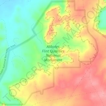
Naam: Topografische kaart Alibates Flint Quarries National Monument, hoogte, reliëf.
Gemiddelde hoogte: 947 m
Minimale hoogte: 890 m
Maximale hoogte: 998 m
Andere topografische kaarten
Klik op een kaart om zijn topografie, zijn hoogte en zijn reliëf te bekijken.
Amarillo
United States > Texas > Potter County
Amarillo, Potter County, Texas, United States
Gemiddelde hoogte: 1.097 m
Amarillo
United States > Texas > Potter County
Amarillo, Potter County, Texas, United States
Gemiddelde hoogte: 1.097 m
Bushland
United States > Texas > Potter County
Bushland, Potter County, Texas, 79012, United States
Gemiddelde hoogte: 1.166 m
Amarillo
United States > Texas > Potter County > Amarillo
Amarillo, Potter County, Texas, 79105, United States
Gemiddelde hoogte: 1.090 m